Avignon Map: Where Every Tour Starts
An Avignon map for a tour day is a map of one walled town with two ends. The station end is where most minivan days leave; the palace end is where most walks begin. Find your kerb here, then check Avignon ticket prices for what each tour covers.
The two ends of the walled town
The walls run 4.3 km round the old town. Avignon Centre station sits just outside them to the south, and the Palais des Papes stands at the northern end, on its rock above the river. The walk between them takes about 15 minutes.
Cours Jean Jaurès runs in from the station gate, past the tourist office, and becomes rue de la République on the way to Place de l'Horloge. Keep to that line and you cannot get lost. The palace square opens just beyond the Horloge.
Where each tour meets you
Your booking names a meeting point. Find it on the map before the day, and arrive ten minutes early. Each entry below comes from the tour's own listing:
| Meeting point | Address | Who meets here | Part of town |
|---|---|---|---|
| The tourist office | 41 cours Jean Jaurès | Most wine days and Provence days, and the e-bike day | Station end |
| Outside Hôtel Le Bristol | 44 cours Jean Jaurès | The lavender day and a wine half day; look for a black car | Station end |
| The central post office | Cours Président Kennedy | A sights walk and the Luberon villages day | Station end |
| The A La Française office | 4 rue de la République | The walk with the palace ticket | Inside the walls |
| Place de l'Horloge | By the carousel, or at the Hôtel de Ville | A food-and-wine walk and the private walk | Centre |
| Place Crillon | 16 Place Crillon | The history walk; be there 10 minutes early | Inside the walls |
| The palace steps | Below the small door on the right | The Taste Avignon food walk | Palace end |
| Restaurant Sevin | 10 rue de Mons, beside the palace | The full Châteauneuf-du-Pape day | Palace end |
| A point given at booking | Shown as a pin in your booking | Two Provence Panorama days | Varies |
No tour collects you from a hotel. The minivan days mostly leave from the station end, so a room near cours Jean Jaurès saves you a walk in the morning. The walks and food walks mostly start near the palace.
Found your meeting point?
Compare the tours that leave from it, with the meeting point on every card.
The monuments on one walk
All the listed monuments sit round the palace square, so you can join them in one loop. Start at the Palais des Papes, then step next door to Notre-Dame des Doms, the cathedral with the gilded Virgin on its tower.
Climb behind it to the Rocher des Doms garden for the view of the river. Then walk down to the Pont Saint-Bénézet, the bridge that stops in the middle of the Rhône. The Petit Palais closes the north side of the square.
Les Halles market, on Place Pie, is a short walk south-east of the palace. Rue des Teinturiers, with its water wheels, lies beyond it, towards the eastern walls.
Stations and car parks
Avignon Centre station and the coach station stand side by side, just outside the southern walls. Avignon TGV lies 6 km further south; a short train ride brings you in to the centre.
The Gare Centre car park is at the station, the Jean Jaurès car park beside the tourist office, and the Palais des Papes car park under the palace square. Les Halles has its own car park on Place Pie. The free park-and-ride sites sit outside the walls, with shuttles in.
Across the river
The Île de la Barthelasse fills the space between the two arms of the Rhône, facing the walls. The free shuttle boat leaves from Quai de la Ligne, near the bridge. Villeneuve lez Avignon is on the far bank beyond it.
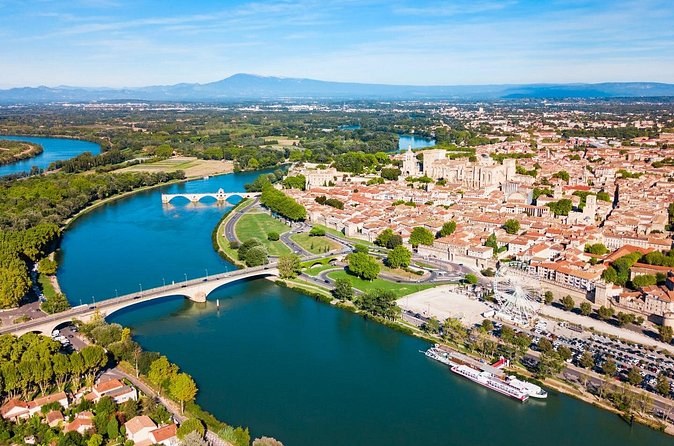
The towpath on the island is the place to see the whole city at once: the bridge, the rock and the palace in one view.
Map of Avignon
Avignon
The walled town, the Rhône
and the island
The map loads from Google only when you press the button. The palace is at the top of the walled town, and the station at the bottom.
Questions about the Avignon map
Where do the day tours start?
Where is the Avignon tourist office?
How far is the Palais des Papes from the station?
How big is the walled town of Avignon?
Where is the Île de la Barthelasse?
Where these facts come from
Every meeting point comes from the tour's own listing. Streets, stations, car parks and the island come from Avignon's tourist office, and the walls' length from its ramparts page, checked 28 September 2026.
- Getting to and around Avignon (Avignon Tourisme)
- Where can I park in Avignon? (Avignon Tourisme)
- The Avignon tourist office: address and hours
- The ramparts of Avignon (Avignon Tourisme, French)
- The covered market: hours (Avignon Tourisme, French)
- The water wheels of rue des Teinturiers (Avignon Tourisme)
- The river island (Avignon Tourisme)
- As the water flows: the free river shuttle (Avignon Tourisme)
- Practical information (the papal palace's own site)
Next: choose a base on where to stay, read Avignon attractions, or compare every tour on Avignon Tours.